
The American Southwest Road Trip: A Region-by-Region Orientation
From the Colorado Plateau to the Sonoran Desert, this guide covers landscapes, distances, climate, and what to realistically expect on a Southwest drive.
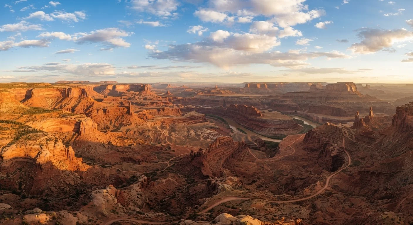
Photo: HorizonMetric.com | One Destination For Everyday Insights editorial
—— In This Article
Key Takeaways
- The Southwest spans four distinct geographic regions, each requiring different planning and expectations.
- Summer heat in lower-elevation deserts can be extreme — timing and hydration planning are essential.
- Driving distances between landmarks are deceptively long; budget more time than you think you need.
- The Colorado Plateau holds the highest concentration of national parks in the country.
- New Mexico offers a culturally rich, less-crowded alternative to more famous Southwest corridors.
Why the Southwest Deserves Its Own Road Trip Logic
The American Southwest is not a single place — it's a collection of ecosystems, cultures, and geological time periods stacked together across roughly 500,000 square miles. A road trip here operates differently than a coastal drive or a mountain loop. Distances are vast, services are sparse, and the landscape shifts so dramatically that you can move from pine forests to canyon floors in under two hours.
Understanding the region's geography before you go is the most useful thing you can do. Whether you're planning a week-long loop or a multi-state expedition, the Southwest rewards travelers who arrive with a clear mental map. For a broader picture of how this region fits into America's driving landscape, see America's most iconic road trip routes.
11
National Parks on the Colorado Plateau
The Colorado Plateau hosts more national parks than any other geographic region in the United States.
134°F
Highest recorded temperature at Death Valley
Death Valley holds the record for the highest reliably recorded air temperature on Earth, per the World Meteorological Organization.
~500K sq mi
Area of the American Southwest
The broader American Southwest region spans parts of Arizona, Utah, Nevada, Colorado, New Mexico, and California.
The Colorado Plateau: Red Rock Country
Straddling Utah, Arizona, Colorado, and a corner of New Mexico, the Colorado Plateau is the geographic heart of any Southwest road trip. This elevated tableland — averaging around 5,000 to 6,000 feet above sea level — is where most of the region's celebrated national parks cluster: Zion, Bryce Canyon, Canyonlands, Arches, Capitol Reef, and the Grand Canyon's North and South Rims all sit within its boundaries.
The plateau's signature feature is its layered sandstone, carved by rivers and wind into mesas, arches, spires, and slot canyons. Driving across it means navigating switchbacks, single-lane overlooks, and unpaved roads that require high clearance in places. Cell service disappears frequently, and fuel stations can be 60 or more miles apart.
Download offline maps for the entire Colorado Plateau before you leave your last major city — cell service drops without warning in canyon country, and GPS alone won't save you.
Vast stretches of Utah and northern Arizona have no carrier signal for dozens of miles, making offline navigation an essential safety measure rather than a convenience.
Book lodging inside or adjacent to national parks three to six months ahead if you're traveling between April and October — gateway towns like Springdale (Zion) and Moab fill up fast.
Plateau national parks have seen record visitation in recent years, and last-minute accommodations near popular entrances are scarce and often far more expensive than planning ahead.
For travelers building their itinerary around national parks, planning a drive-through tour of America's public lands offers practical guidance on passes, timing, and crowd patterns.
The Sonoran and Mojave Deserts: Heat, Cacti, and Open Sky
Drop below the plateau and you enter the low desert — two of North America's most distinctive: the Sonoran Desert covering southern Arizona and reaching into California, and the Mojave spanning southeastern California and southern Nevada. These are hotter, drier, and more visually stark than the plateau above them.
The Sonoran is defined by its iconic saguaro cacti, which grow nowhere else on Earth in such density. Saguaro National Park near Tucson and Organ Pipe Cactus National Monument offer immersive drives through this ecosystem. The Mojave, meanwhile, contains Joshua Tree National Park and Death Valley — the latter reaching some of the highest reliably recorded air temperatures on Earth.
Desert Heat Is a Genuine Safety Risk
Summer temperatures in the Sonoran and Mojave deserts regularly exceed 110°F, creating life-threatening conditions for unprepared travelers. Carry a minimum of one gallon of water per person per day for desert hiking, and check your vehicle's coolant level before driving into extreme heat. Always inform someone of your route if venturing onto remote roads.
Both deserts are genuinely dangerous in summer. Midday temperatures in July and August regularly exceed 110°F at lower elevations. If you travel during these months, plan outdoor activities for early morning, carry far more water than you think necessary, and never rely solely on your vehicle's coolant system in extreme heat.
New Mexico's High Desert and Mountain Corridor
New Mexico is often overshadowed by its neighbors, but it offers one of the most culturally layered road trip experiences in the entire country. The state's terrain ranges from the gypsum dunes of White Sands National Park to the forested peaks of the Sangre de Cristo Mountains above Santa Fe and Taos.
The Rio Grande corridor connecting Albuquerque, Santa Fe, and Taos is compact enough for a focused four- or five-day loop, and it packs in ancient Pueblo sites, Spanish colonial architecture, and world-class art institutions alongside dramatic high desert scenery. New Mexico's cuisine is distinctly its own — and very much worth factoring into your route. Regional food stops that belong on any American road trip includes New Mexico's green and red chile tradition as one of the country's most geographically specific eating experiences.
Distances, Climate, and What to Realistically Expect
The Southwest's scale surprises nearly every first-time visitor. Phoenix to the Grand Canyon's South Rim is about 230 miles — nearly four hours under normal conditions. Albuquerque to Moab, Utah runs close to 300 miles. These aren't detours; they're the main route. Budget generously for drive time and resist the urge to over-program each day.
Climate varies enormously by elevation and season. Spring (March through May) and fall (September through November) are broadly considered the most comfortable windows across most of the region, though both can bring sudden storms. Monsoon season typically affects Arizona and New Mexico from July through mid-September, bringing brief but intense afternoon thunderstorms that can flood canyon roads with little warning.
Flash Flood Risk in Canyon Country
Slot canyons and low-water crossings in Arizona and Utah can flood within minutes during monsoon season, even when skies above you appear clear. Check local weather forecasts and flash flood advisories from the National Weather Service before entering canyon areas. Many guided tours require cancellation if conditions are uncertain — take those precautions seriously.
For travelers weighing the Southwest against other American driving experiences, coastal highway vs. interior routes offers a useful framework for comparing the two styles.
Planning Your Route: Where to Start
Most Southwest road trips anchor around one of three gateway cities: Las Vegas, Phoenix, or Albuquerque. Each provides major airport access, car rental options, and a logical jumping-off point for different regions. Las Vegas puts you closest to Zion, Bryce, and the Mojave. Phoenix opens up the Sonoran Desert and the Grand Canyon's South Rim. Albuquerque centers you in New Mexico and within striking distance of the Colorado Plateau.
There's no single correct circuit — the region is flexible enough to support loops, one-way drives, and modular add-ons. What matters most is matching your itinerary to your pace. The Southwest punishes rushed travelers and rewards those who linger. Explore the full range of American driving options at our US Road Trips hub to see how a Southwest journey fits into the broader picture.

Travel Editorial Team
Travel Editorial Team is the collective byline for our editorial team and contributor network. Articles published under this byline or an editorial pen name are researched, written, and reviewed according to our editorial standards for clarity, consistency, and independence before publication.
View author profile