
The Pacific Coast Highway: A Driver's Guide to California's Route 1
Everything you need to know about driving Route 1 — key stops, seasonal considerations, road conditions, and what to realistically plan for.
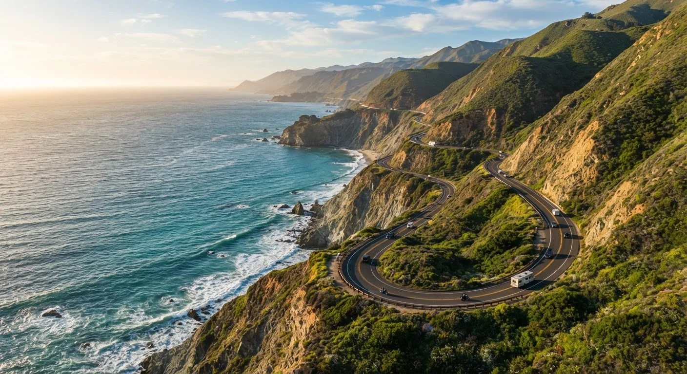
Photo: HorizonMetric.com | One Destination For Everyday Insights editorial
—— In This Article
Key Takeaways
- Route 1 stretches roughly 655 miles along the California coast, from Orange County to Leggett.
- Spring and fall offer the best balance of mild weather, open roads, and fewer crowds.
- Sections near Big Sur are prone to closures from landslides — always check Caltrans before departing.
- Allow at least three to five days to drive the full length without feeling rushed.
- Cell service can disappear for long stretches; download offline maps before you go.
What Is the Pacific Coast Highway?
California's Route 1 — widely known as the Pacific Coast Highway, or PCH — is one of the most celebrated drives in the United States. Stretching roughly 655 miles from Dana Point in Orange County up to Leggett in Mendocino County, it traces the edge of the continent with an intimacy that no inland freeway can match. Ocean cliffs, redwood groves, surf towns, and state parks appear in quick succession, making every hour behind the wheel feel like a reward in itself.
The highway is officially designated as California State Route 1, though the nickname "Pacific Coast Highway" is commonly applied to the full coastal corridor. Technically, the PCH designation applies only to a stretch through Los Angeles County, but travelers use the term loosely — and you will too once you're out there. It connects iconic communities including Malibu, Santa Barbara, San Luis Obispo, Big Sur, Monterey, Santa Cruz, and Half Moon Bay.
If you're curious how Route 1 compares to other legendary American drives, our guide to America's most iconic road trip routes puts it in excellent context.
655 mi
Total length of California's Route 1
Route 1 spans from Dana Point in Orange County to Leggett in Mendocino County, per Caltrans route data.
90 mi
Gas-station gap through Big Sur
The stretch between Cambria and Carmel has very limited fuel stops — one of the longest rural gaps on the route.
3–5 days
Recommended minimum drive time
Travel writers and frequent Route 1 drivers consistently recommend at least three days for a meaningful experience.
Best Times to Drive Route 1
Timing shapes the entire Route 1 experience. Late spring (April–May) and early fall (September–October) are generally considered the sweet spots. Temperatures stay comfortable, wildflowers dot the hillsides above Big Sur, and you'll share the road with noticeably fewer vehicles than in peak summer.
Summer draws the largest crowds — especially on holiday weekends — and coastal fog (called the "marine layer") can settle in for hours along the Central Coast, obscuring the very views you came for. That said, summer is still a perfectly enjoyable time to drive; just book accommodations well in advance and hit the road early in the morning before fog thickens and traffic builds.
Winter offers solitude and dramatic storm-lit scenery, but brings real risks: rain-softened hillsides above Big Sur can trigger landslides that close the road for weeks or even months at a time. Check the coastal versus interior route tradeoffs if you're weighing flexibility against scenery.
Morning Fog Is Part of the Experience
If you wake up to a socked-in coastline, don't panic — marine layer typically burns off by late morning. Plan leisurely breakfasts or inland detours in the early hours, then hit the coastal viewpoints by midday for the clearest skies and best light for photos.
Key Stops Along the Way
Route 1's greatest strength is its density of worthwhile stops. Here are highlights that reward a slower pace:
- Malibu & Point Mugu: Start with dramatic rocky coves and the Santa Monica Mountains descending to the sea.
- Santa Barbara: Spanish colonial architecture, a walkable waterfront, and wine country just minutes inland.
- Hearst Castle (San Simeon): One of California's most visited historic landmarks, perched on a coastal hilltop.
- Elephant Seal Vista Point (Piedras Blancas): A free, roadside colony of hundreds of northern elephant seals — genuinely unforgettable.
- Big Sur: The dramatic centerpiece of the drive. Bixby Creek Bridge, McWay Falls, Pfeiffer Beach, and Andrew Molera State Park are all within a 30-mile stretch.
- 17-Mile Drive (Pebble Beach): A privately managed toll scenic road through Monterey cypress forests and coastal bluffs.
- Santa Cruz: Beach boardwalk energy, surf culture, and a lively downtown — a natural rest stop before the Bay Area.
Visit Pfeiffer Beach in Big Sur on a weekday morning and arrive before 9 a.m. — the parking lot is small, fills by mid-morning on weekends, and a ranger will turn you away once it's full.
Pfeiffer Beach is one of Big Sur's most photogenic spots but has extremely limited parking; early arrival is the only reliable way in.
When pulling off at scenic overlooks, turn off your hazard lights once you're safely stopped — leaving them on signals distress and can attract highway patrol unnecessarily.
A common beginner mistake on scenic byways; hazard lights are for emergencies or a true breakdown, not a parking substitute.
Road Conditions and Safety
Route 1 is not a highway you can drive on autopilot. In many stretches — especially through Big Sur — it's a narrow two-lane road clinging to steep coastal cliffs with no guardrail in sight. Speed limits range from 25 to 55 mph, and slow RVs or tour buses can back up traffic on curves with no passing opportunity for miles.
Check for Closures Before Every Trip
Big Sur's Route 1 has a documented history of extended closures due to landslides, particularly after heavy rain. A section shuttered for more than a year following the 2017 Mud Creek slide. Always verify current road status on Caltrans QuickMap before departing — do not assume the road is open based on a previous visit or an outdated travel blog.
Before any trip, check Caltrans QuickMap (quickmap.dot.ca.gov) for real-time closures and road conditions. Big Sur has experienced multiple extended closures in recent years due to landslides — most famously in 2017, when a section was shut for over a year. Closures can happen seasonally with little warning.
Cell service drops out reliably between Big Sur and Carmel. Download an offline map (Google Maps and Maps.me both allow this) before leaving your last reliable signal. If you're new to longer drives, our first cross-country drive guide covers navigation basics worth reviewing.
Planning Your Itinerary
The full 655-mile drive can technically be completed in a single long day — but doing so would mean missing almost everything that makes Route 1 worth driving. A realistic minimum is three days for a highlights-only trip; five to seven days lets you breathe, hike, and actually stop at viewpoints instead of glimpsing them in a mirror.
A common approach is to drive south to north, keeping the ocean on your left side for clearer views and more natural pull-offs. Starting in Los Angeles (or even San Diego) and ending in San Francisco makes for a natural city-to-city narrative.
Sample three-day skeleton:
- Day 1: LA to San Luis Obispo — Malibu, Point Dume, Santa Barbara, Solvang detour optional (~230 miles)
- Day 2: SLO to Monterey — Elephant Seal Vista Point, Big Sur corridor, 17-Mile Drive (~150 miles)
- Day 3: Monterey to San Francisco — Santa Cruz, Half Moon Bay, Pacifica (~120 miles)
If you enjoy the open-road contrast, the American Southwest road trip is a natural companion adventure once you've conquered the coast.
“The California coast is a world apart — it doesn't ease you in. It drops you right into the drama of it, and you're either ready to slow down and receive it or you miss the whole thing.”
— James D. Houston, California author and writing instructor, known for works exploring the California coast and landscape
What to Pack and Prepare
Route 1 rewards drivers who prepare for its quirks rather than assume it behaves like a freeway. A few practical essentials:
- Full gas tank at every opportunity. Gas stations are scarce between Big Sur and Carmel — a stretch of nearly 90 miles. Fill up in San Luis Obispo or Cambria heading north, and in Monterey heading south.
- Layers. Coastal temperatures can swing 30°F between a sunny inland viewpoint and a foggy beach cove within the same hour.
- Offline navigation. Download your route before departure — do not rely on live directions through Big Sur.
- Patience for slow-moving traffic. Scenic pull-offs cause sudden stops. Keep following distances generous.
- A physical backup map. Old-school but genuinely useful if your phone dies in a no-signal zone.
For a comprehensive gear checklist, our road trip packing list covers everything worth having in your car before a long American drive.
Watch for Wildlife on the Road
Deer, condors, and even the occasional elephant seal near beaches can appear on or near the roadway in Big Sur and along Piedras Blancas. Drive at or below posted speed limits, especially at dusk and dawn when wildlife is most active. A collision in a remote stretch can leave you far from assistance.

Travel Editorial Team
Travel Editorial Team is the collective byline for our editorial team and contributor network. Articles published under this byline or an editorial pen name are researched, written, and reviewed according to our editorial standards for clarity, consistency, and independence before publication.
View author profile